Station 1: Alex
Images, Visualization, and Analysis
Click the corresponding arrow to select either a row or column of images for comparison in the Image Analysis Toolkit.
The photos in this image pair look east.
The photos in this image pair look east.


|


M. Nidd, 1945, Image 4
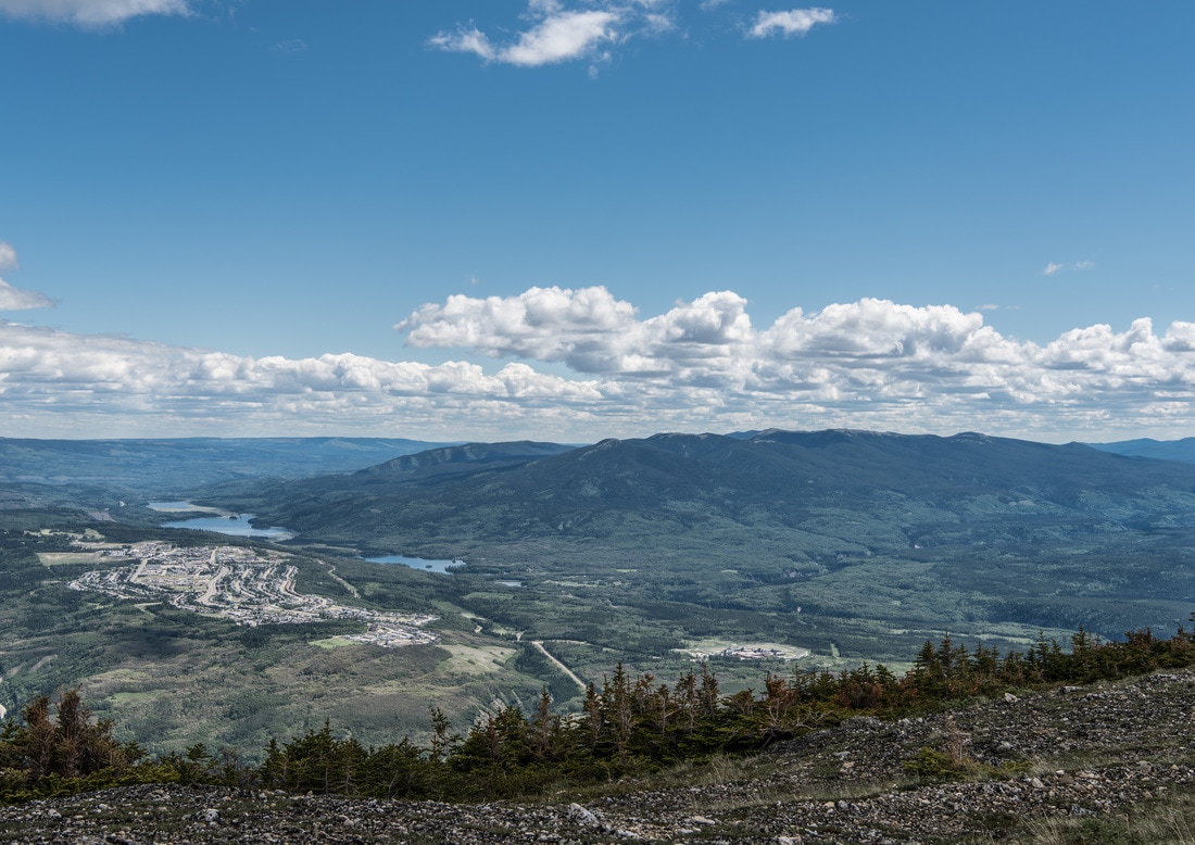
MLP, 2016, Image 267
|
|

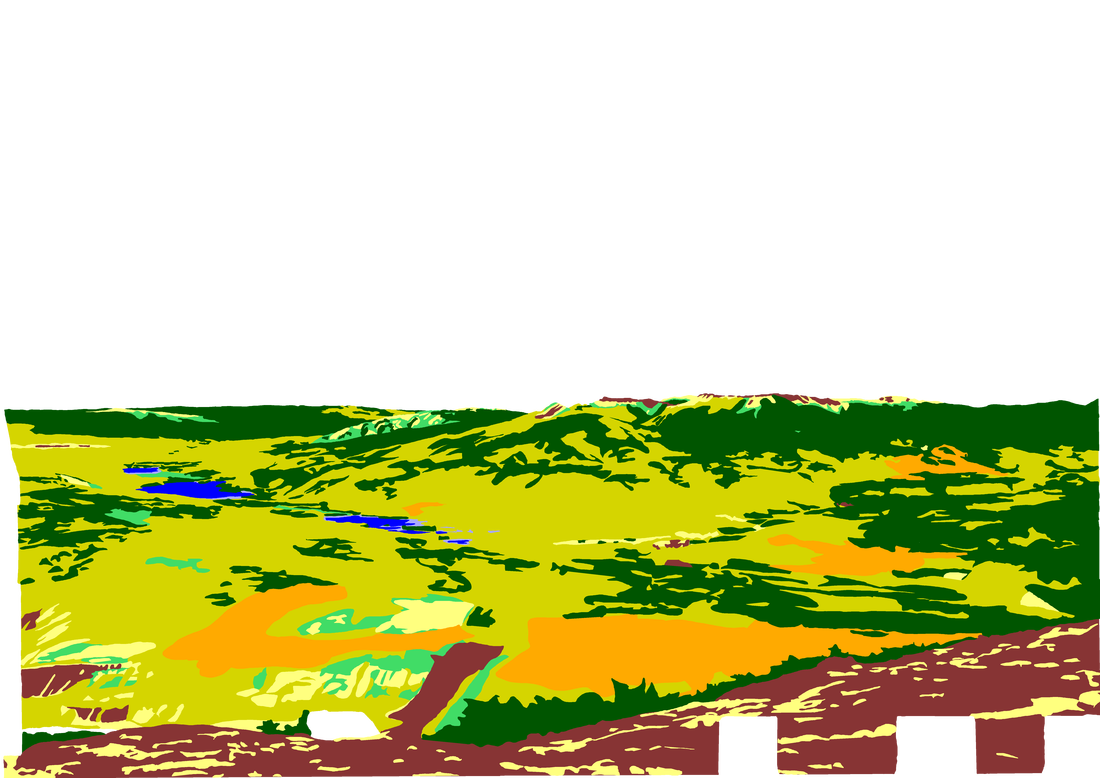
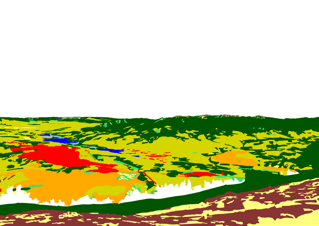
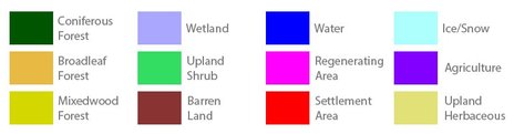
Category Key
Station Information
|
|
The historic images were taken in 1945 by Michael Nidd. The historic and modern image pair can be seen at Stn 1: Alex, Image 4 and Image MLP_0267 The station has a number of other image pairs available for viewing. All of the images from this station are available at explore.mountainlegacy.ca The Google Map shows the location of the station, the direction of view for this image pair, and the general area covered. |
Analysis and Discussion
Analysis of Percentage per Category in 1945 Image 4 and 2016 Image 267
|
Discussion
|
This station, along with Stns 10 and 12, exhibit the smallest amount of change visible within the photographs. As well, this station provides the closest view of Grande Cache itself, with 4.8% of the modern image showing settlement areas. This percentage is close to Stn 12 Mt Stearn, which shows 4.3% of the 2016 image in settlement area -- not surprising as Stn 1 Alex is only 1.2 km north of Stn 12. The view from Stn 1 Alex is more easterly than Stn 12. Stn 1 looks east down Highway 40 until it curves around the small ridge of hills southwest of the airport.
Perhaps one of the most interesting point to note is the slow advance of conifers up the slope in the foreground. That, along with the similarities in barren ground and herbaceous cover between the two images in this same area might indicate harsh weather conditions for a ridge that is just below 2000 metres. Coniferous stands on the Mt Louie - Cowlick Peak ridge on the middle right of the image pairs appear to be increasing in the 2016 image. Using the Image Analysis Toolkit, and zooming in to look at just the Mt Louie - Cowlick Peak area an increase of approximately 6% between 1945 and 2016 can be seen in the photos. Keeping the focus on coniferous stands, and zooming in even further to the small ridge southwest of the airport an increase in approximately 13% in the 2016 image can be seen. |
