Station 10: Mt Louie
Images, Visualization, and Analysis
Click the corresponding arrow to select either a row or column of images for comparison in the Image Analysis Toolkit.
The photos in this image pair look west.
The photos in this image pair look west.


|

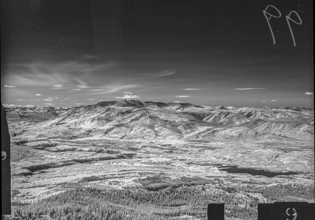
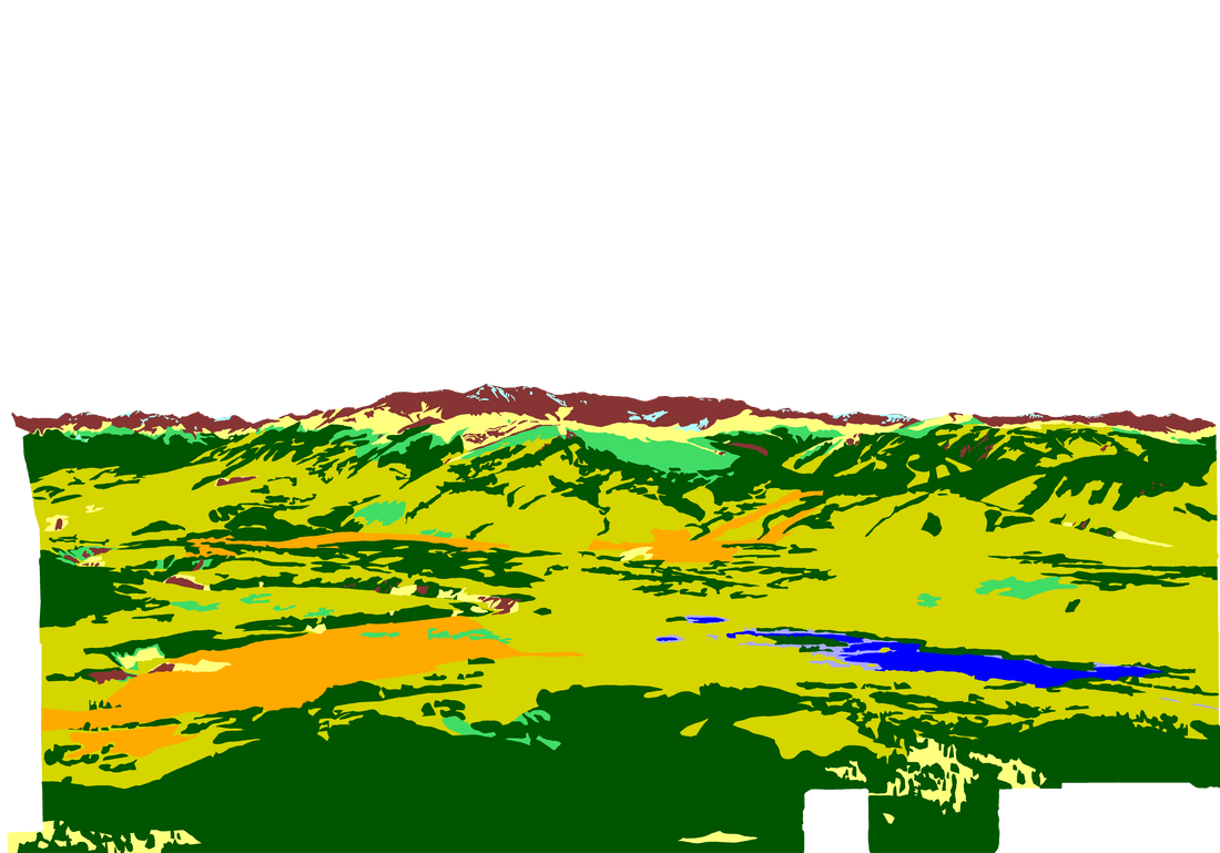
M. Nidd, 1946, Image 99

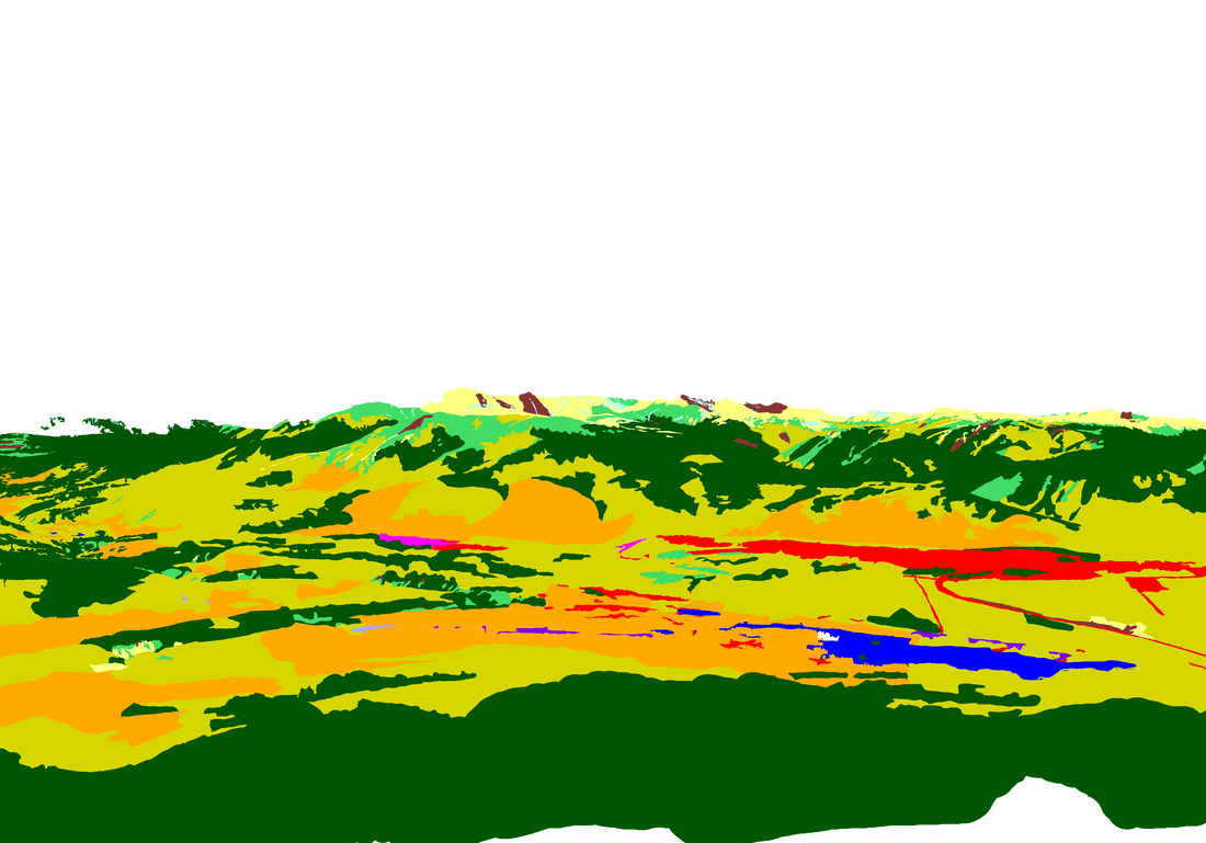
MLP, 2016, Image 739
|
|

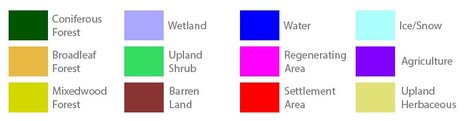
Category Key
Station Information
|
|
The historic images were taken in 1946 by Michael Nidd. The historic and modern image pair can be seen at Stn 10: Mt Louie, Image 99 and Image MLP_0739 The station has a number of other image pairs available for viewing. All of the images from this station are available at explore.mountainlegacy.ca The Google Map shows the location of the station, the direction of view for this image pair, and the general area covered. |
Analysis and Discussion
Analysis of Percentage per Category in 1946 Image 99 and 2016 Image 739
|
Discussion
|
The view in this image pair is north-northwest towards Grande Mtn with Grande Cache and smaller settlements visible. Evidence of a larger fire event appears across the landscape as wildfire refugia -- unburned or less severely burned patches that remain after a wildfire -- are evident on the slopes in these photos. This image pair, along with Stn 12, exhibits the least change of any in the area. However, some change is still evident, especially the increase in broadwood stands. The 2016 image shows an increase of 7.6% in deciduous cover over the 1946 classification image. Broadleaf Forest is one of the most difficult categories to segment, especially in the historic image where the texture of the more rounded canopy of deciduous stands is often the key factor that helps put an area into the Broadleaf Forest category rather than the Mixedwood. Some movement in the historic image makes it look like it was windy day back in 1946 when Michael Nidd and his crew took this picture. That can make broadleaf stands even more difficult to identify. However, in the 2016 image it looks like broadleaf stands have increased in areas where human activity is observed -- for example around settlement, agriculture, and regenerating areas.
Ridgeline areas are also of interest as it appears that the categories are changing with larger vegetation types (e.g. coniferous, mixedwood, and shrubs) creeping up-slope. For example, some of the ridgetop Barren Land category in the 1946 image has changed to Upland Herbaceous in the 2016 image. Ridgetop Upland Herbaceous in the 1946 shot has filled in with Upland Shrub in 2016, and 1946 Upland Shrub in the same area has turned into Mixedwood Forest and Coniferous Forest in the 2016 image. |
