Station 12: Mt Stearn
Images, Visualization, and Analysis
Click the corresponding arrow to select either a row or column of images for comparison in the Image Analysis Toolkit.
The photos in this image pair look east - northeast.
The photos in this image pair look east - northeast.


|

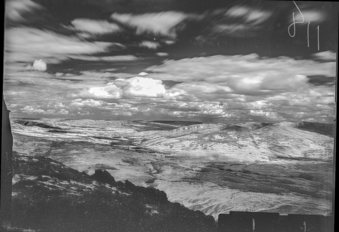
M. Nidd, 1946, Image 118
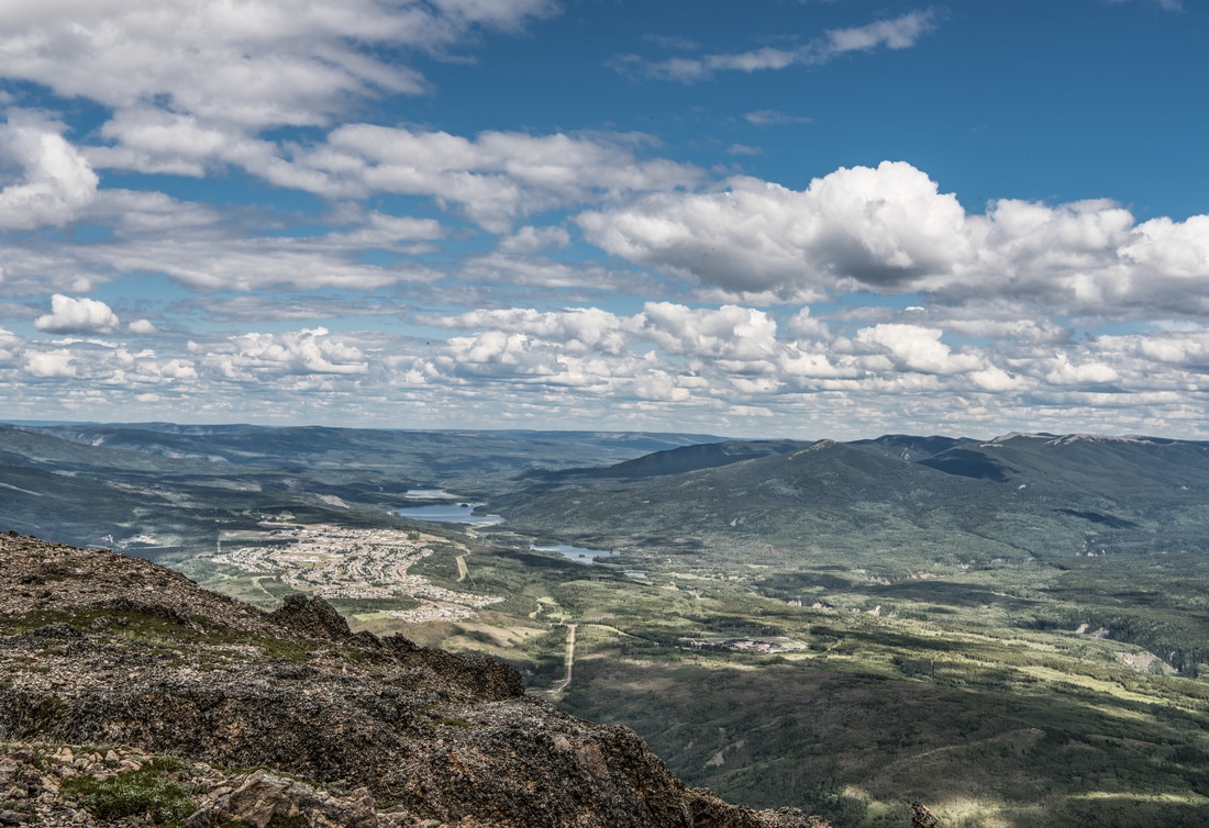
MLP, 2016, Image 330
|
|


Category Key
Station Information
|
|
The historic images were taken in 1946 by Michael Nidd. The historic and modern image pair can be seen at Stn 12: Mt Stearn, Image 118 and Image MLP_0330 The station has a number of other image pairs available for viewing. All of the images from this station are available at explore.mountainlegacy.ca The Google Map shows the location of the station, the direction of view for this image pair, and the general area covered. |
Analysis and Discussion
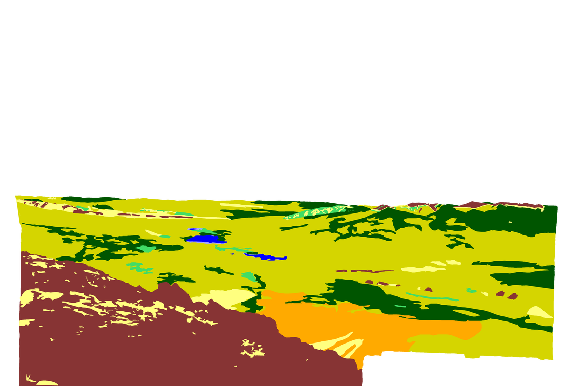
Analysis of Percentage per Category in 1946 Image 118 and 2016 Image 330
|
Discussion
|
This image pair, along with Stn 10 and Stn 1, exhibits the least change of any in the area. However, some change is still evident, especially comparing the broadwood stands between 1946 and 2016: the 2016 image shows an decrease of 6.5% over the 1946 classification image. Broadleaf Forest is one of the most difficult categories to segment, especially in the historic image where the texture of the more rounded canopy of broadleaf stands is often the key factor that helps put an area into the Broadleaf Forest category rather than the Mixedwood. The1946 image from this station was difficult to classify as it must have been a very windy day (note the movement in the clouds) when Michael Nidd and his crew took this picture. Motion blur in the image can make broadleaf stands even more difficult to identify. However, in the 2016 image it looks like broadleaf stands have indeed changed to mixedwood, especially in the area in the lower centre of the image pairs. Perhaps it might be best to consider lump the Broadleaf and Mixedwood Forest categories together as they are so difficult to segment accurately.
Ridgeline areas along Mt. Louie (sky line on the right of the image pairs) shows coniferous stands creeping up-slope with only a small summit area left exposed as rock/dirt. Although not classified as such, there may be some evidence of fire on the low ridge to the northeast of Mt. Louie in the 2016 image (centre right of image). Although not clearly delimited in the 1946 image the meadow-like patches on the plateau in the centre of the image might be evidence of frequent anthropogenic fire keeping these areas open. The same system of patches can be viewed more clearly the 1945 image for Stn 1 Alex. A question to consider: was the Highway 40 corridor an historic travel and/or use corridor? |
