Station 15: Mt Hamell
Images, Visualization, and Analysis
Click the corresponding arrow to select either a row or column of images for comparison in the Image Analysis Toolkit.
The photos in this image pair look south - southeast.
The photos in this image pair look south - southeast.


|

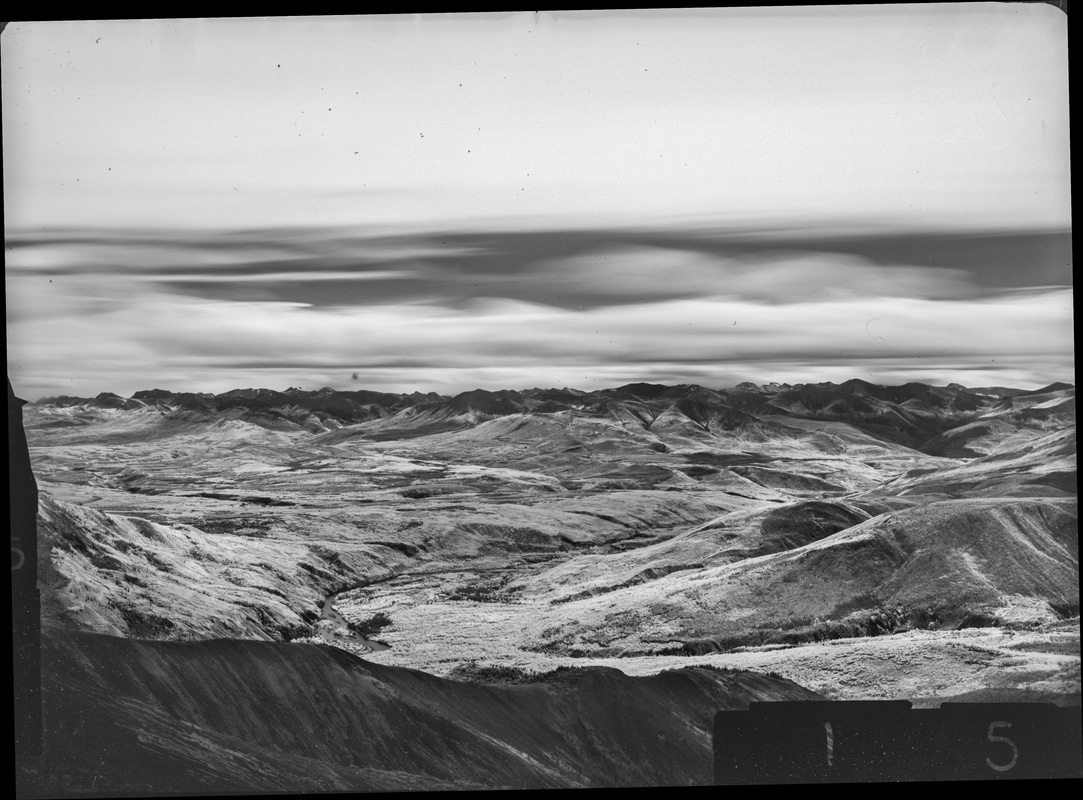
M. Nidd, 1946, Image 155
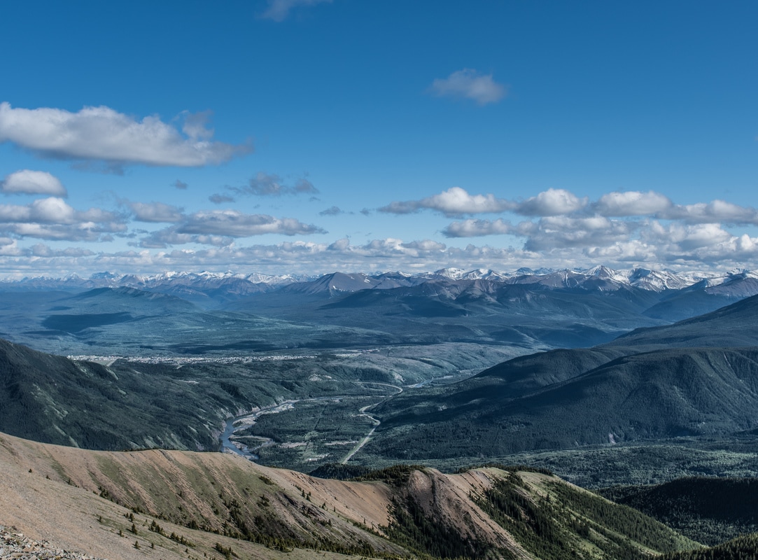
MLP, 2016, Image 248
|
|

Category Key
Station Information
|
|
The historic images were taken in 1946 by Michael Nidd. The historic and modern image pair can be seen at Stn 15: Mt Hamell, Image 155 and Image MLP_0248 The station has a number of other image pairs available for viewing. All of the images from this station are available at explore.mountainlegacy.ca The Google Map shows the location of the station, the direction of view for this image pair, and the general area covered. |
Analysis and Discussion
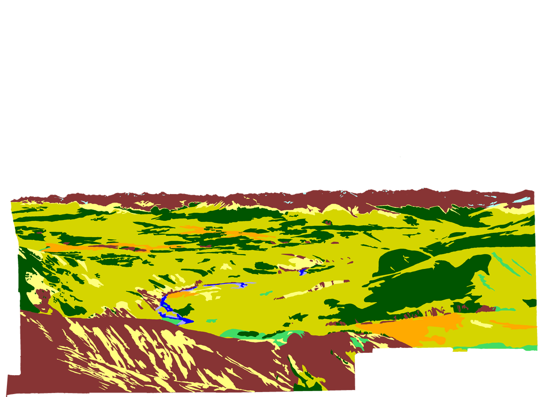
Analysis of Percentage per Category in 1946 Image 155 and 2016 Image 248
|
Discussion
|
The largest change evident in these images is the increase in coniferous forest between the 1946 and 2016 pictures (approximately 24.5% increase) and the decrease in mixedwood stands (approximately 15.6% decrease).
Barren ground (rock, sand, dirt) also shows a decrease between the historic and modern images (approximately 8.7%). Some of that can be accounted for by snow in the upper alpine in 2016 and not in 1946. However, it is possible some barren ground has been replaced by treeline ecotone (a region of transition between two biological communities) creeping up the mountainsides. The Mt Hamell station provides a good view to the south over the landscape in the Grande Cache area. Comparison of the coniferous forest between 1946 and 2016 indicates increasing fuel loading in the area to the south of the community. Increases like these can point to the potential for a large scale fire event in the future. Figure 1 below shows what the 2016 Coniferous Category was composed of in 1946. 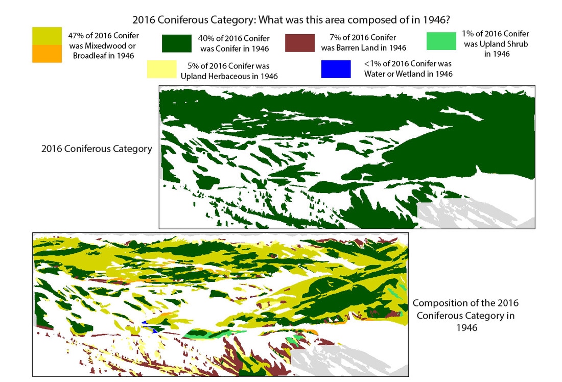
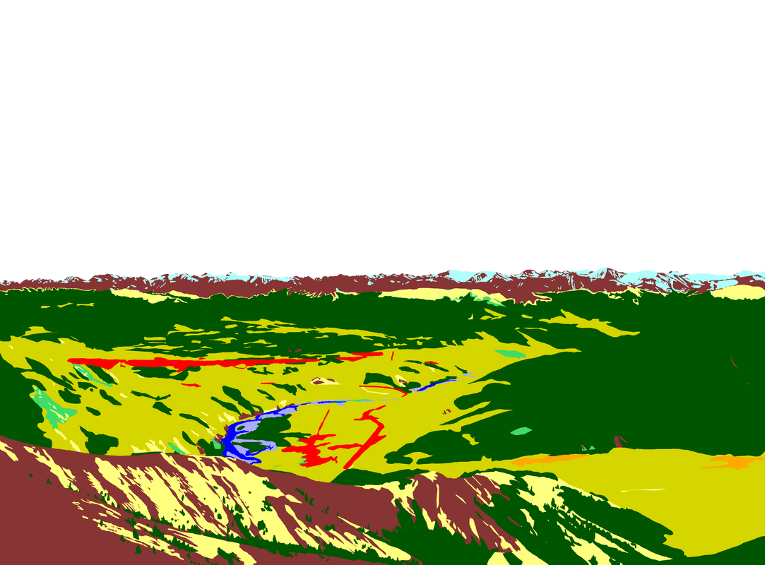
Figure 1: 2016 Coniferous Category filled with 1946 Categories.
|
