Station 13: Ambler Mtn
Images, Visualization, and Analysis
Click the corresponding arrow to select either a row or column of images for comparison in the Image Analysis Toolkit.
The photos in this image pair look southeast.
The photos in this image pair look southeast.


|

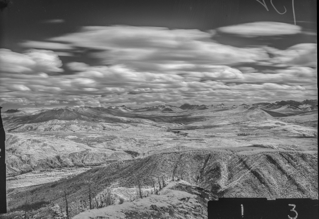
M. Nidd, 1946, Image 132
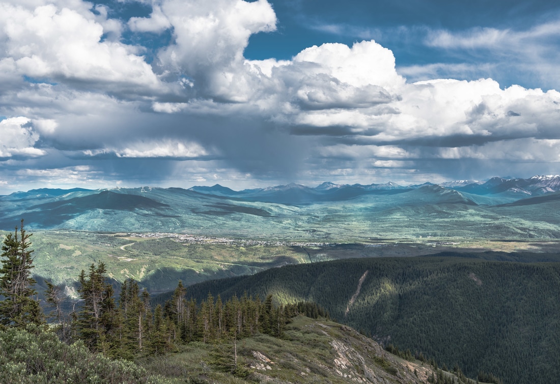
MLP, 2016, Image 355
|
|


Category Key
Station Information
|
|
The historic images were taken in 1946 by Michael Nidd. The historic and modern image pair can be seen at Stn 13: Ambler Mtn, Image 132 and Image MLP_0355 The station has a number of other image pairs available for viewing. All of the images from this station are available at explore.mountainlegacy.ca The Google Map shows the location of the station, the direction of view for this image pair, and the general area covered. |
Analysis and Discussion
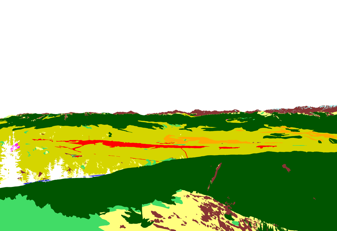
Analysis of Percentage per Category in 1946 Image 132 and 2016 Image 355
|
Discussion
|
The images in this southeast view show evidence of a harsh climate with strong winds and a short growing season. In-fill of coniferous stands, especially up the ridge in the foreground of the 2016 image, is particularly noticeable. In the 2016 image some of the treeline ecotone appears to be heading up slope in comparison to the 1946, however, those mountains and ridges are distant from the station and the image quality for resolving distant objects is not as clear in the 1946 as one might like. As in all of the other image pairs, mixedwood and broadleaf stands predominate on the plateau and area directly around Grande Cache. Interestingly, a bit more of the Smokey River is visible in the 2016 image despite an increase in the conifers growing up on the western slopes of the river. Perhaps the river experienced a flood event in the intervening years that brought down the mixedwood stands along the banks and on small islands in the river, allowing for a more unobstructed view.
The Upland Shrub category in the 2016 photo is over-reported because of the shrubs in the lower left of the image. Removing those shrubs from the 2016 image gives a classification percentage of 0.7% -- much closer to the 1946 image value of 0.8%. However, exploring the foreground in both image pairs gives an good example of how a regenerating area can fill in. There is evidence of multiple fire patterns and age classes in the historic image. Indeed, evidence of a fire on the northeast (left) side of the ridge in the foreground is clear in the 1946 image. Its regrowth pattern to a coniferous stand with shrubs on the margins is clear in the 2016 image. The 2016 image shows considerable infill and/or aging of surrounding forest structure. |
