Station 8A: Hayden Ridge
Images, Visualization, and Analysis
Click the corresponding arrow to select either a row or column of images for comparison in the Image Analysis Toolkit.
The photos in this image pair look north - northwest.
The photos in this image pair look north - northwest.


|


M. Nidd, 1946, Image 81
MLP, 2016, Image 686
|
|

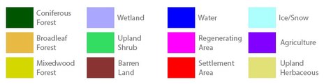
Category Key
Station Information
|
|
The historic images were taken in 1946 by Michael Nidd. The historic and modern image pair can be seen at Stn 8: Hayden Ridge, Image 81 and Image MLP_0686 The station has a number of other image pairs available for viewing. All of the images from this station are available at explore.mountainlegacy.ca The Google Map shows the location of the station, the direction of view for this image pair, and the general area covered. |
Analysis and Discussion
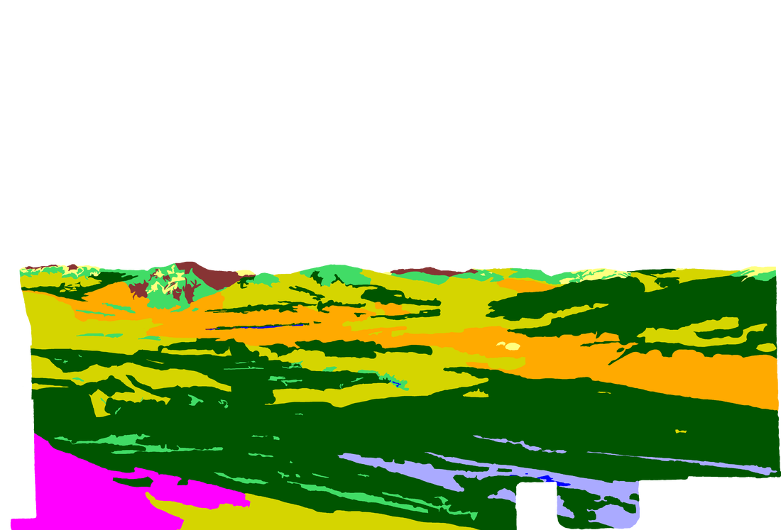
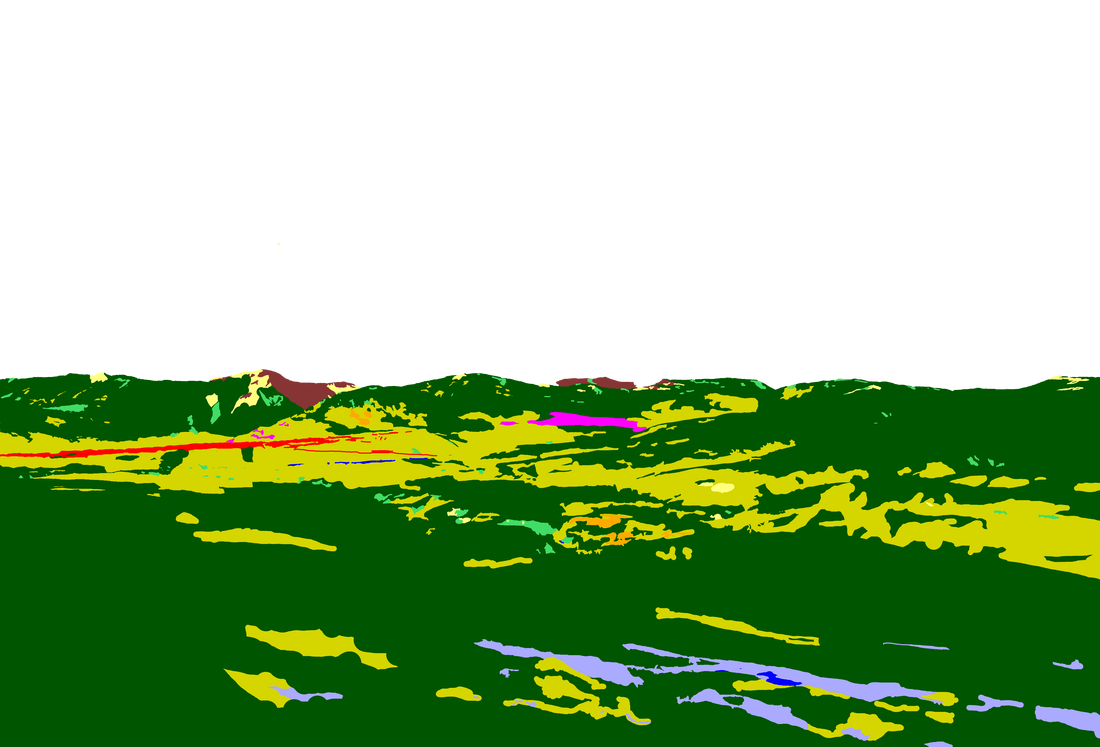
Analysis of Percentage per Category in 1946 Image 81 and 2016 Image 686
|
Discussion
|
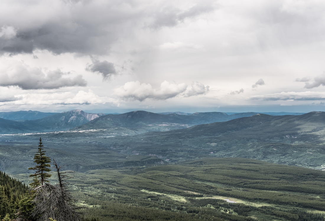
The view in these images is northward with Mt Hamell prominent on the left side and Grande Mtn slightly in front and to the right. Albertine Creek is the large draw in the mid ground left and Cowlick Creek cuts across the mid to far ground in the centre. There appears to be evidence of a recent fire in the left foreground of the 1946 image.
The 2016 image shows harvesting in the distant centre (Regenerating Area category). The stand being harvested in 2016 is evident in the 1946 image. This image pair raises some questions: Was the Highway 40 corridor an historic trail? Was there more anthropogenic fire in that area historically? Are there several fire regimes in this area? If yes, can they be related to different eco-regions? The biggest change evident between the 1946 and 2016 images is the increase in coniferous forest in the 2016 shot (approximately 26% increase) and the decrease in broadleaf stands (approximately 13% decrease). As well, conifers appear to have marched up-slope over the 70 intervening years between the historic and modern photos, while broadleaf stands have largely turned into mixedwood. Change in all of the vegetation and land use types can be examined using the Image Analysis Toolkit . For example, Figure 1 shows the change in conifer stands between the historic and modern images. Figure 2 outlines the area classified as Broadleaf Forest in the 1946 image and shows the categories it has changed into by 2016. 37% of the 1946 Broadleaf Forest category is identified as Mixedwood in the 2016 photo and 18% of it has changed into Coniferous Forest. Click on either of these images to see them in detail. 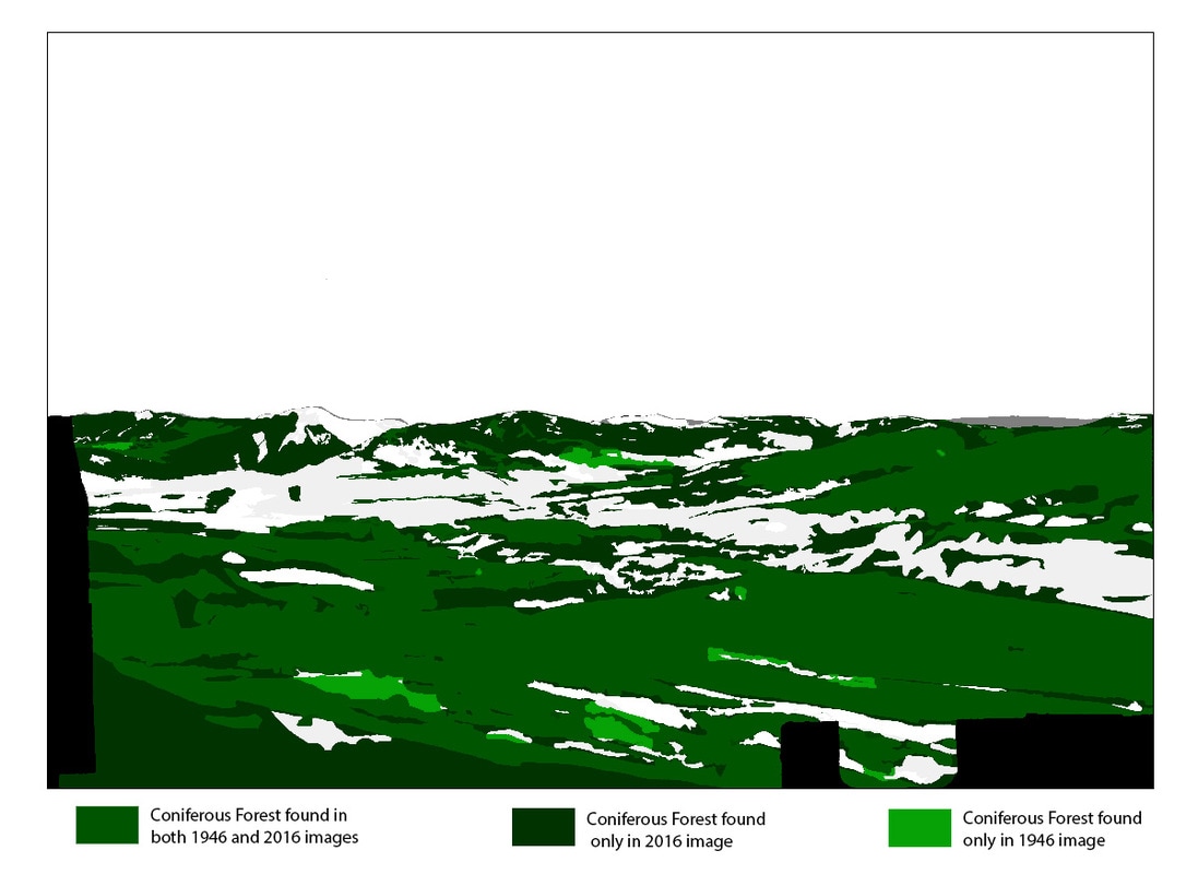
Figure 1: Coniferous Forest change between 1946 and 2016 images.
Stn 8A, Hayden Ridge.
|
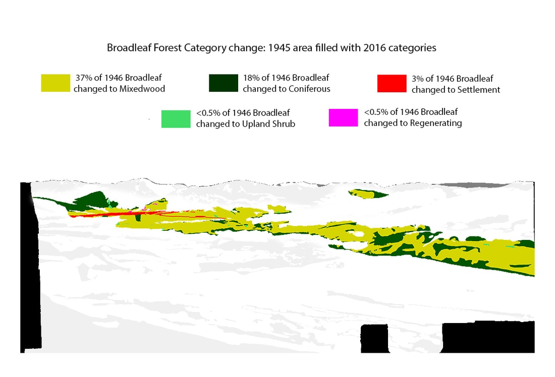
Figure 2: 1945 Broadleaf Forest Category change. Stn. 8A, Hayden Ridge.
