Station 8B: Hayden Ridge
Images, Visualization, and Analysis
Click the corresponding arrow to select either a row or column of images for comparison in the Image Analysis Toolkit.
The photos in this image pair look north - northeast.
The photos in this image pair look north - northeast.


|

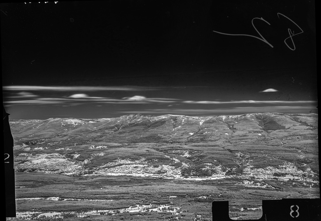
M. Nidd, 1946, Image 82
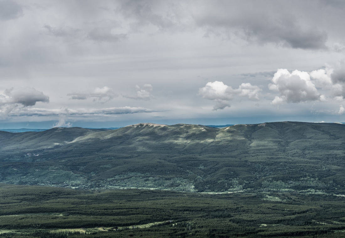
MLP, 2016, Image 689
|
|

Category Key
Station Information
|
|
The historic images were taken in 1946 by Michael Nidd. The historic and modern image pair can be seen at Stn 8: Hayden Ridge, Image 82 and Image MLP_0689 The station has a number of other image pairs available for viewing. All of the images from this station are available at explore.mountainlegacy.ca The Google Map shows the location of the station, the direction of view for this image pair, and the general area covered. |
Analysis and Discussion
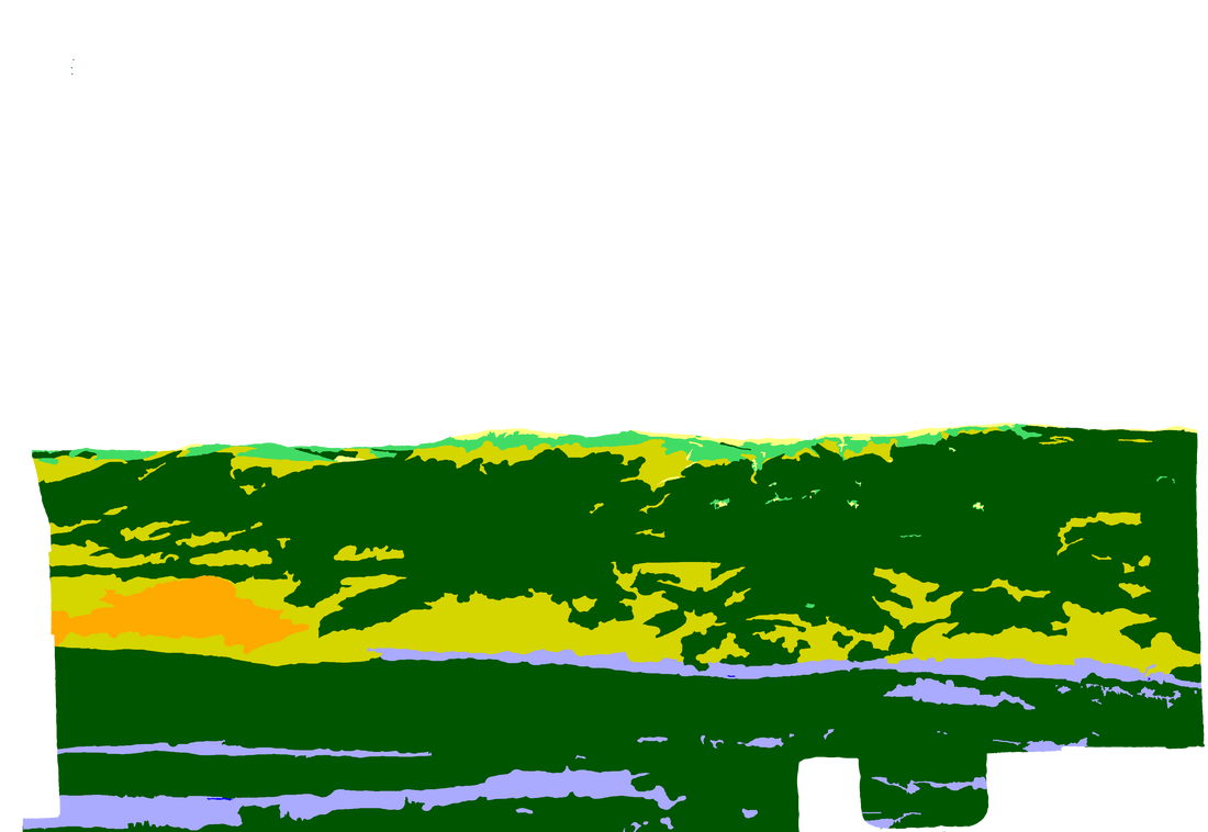
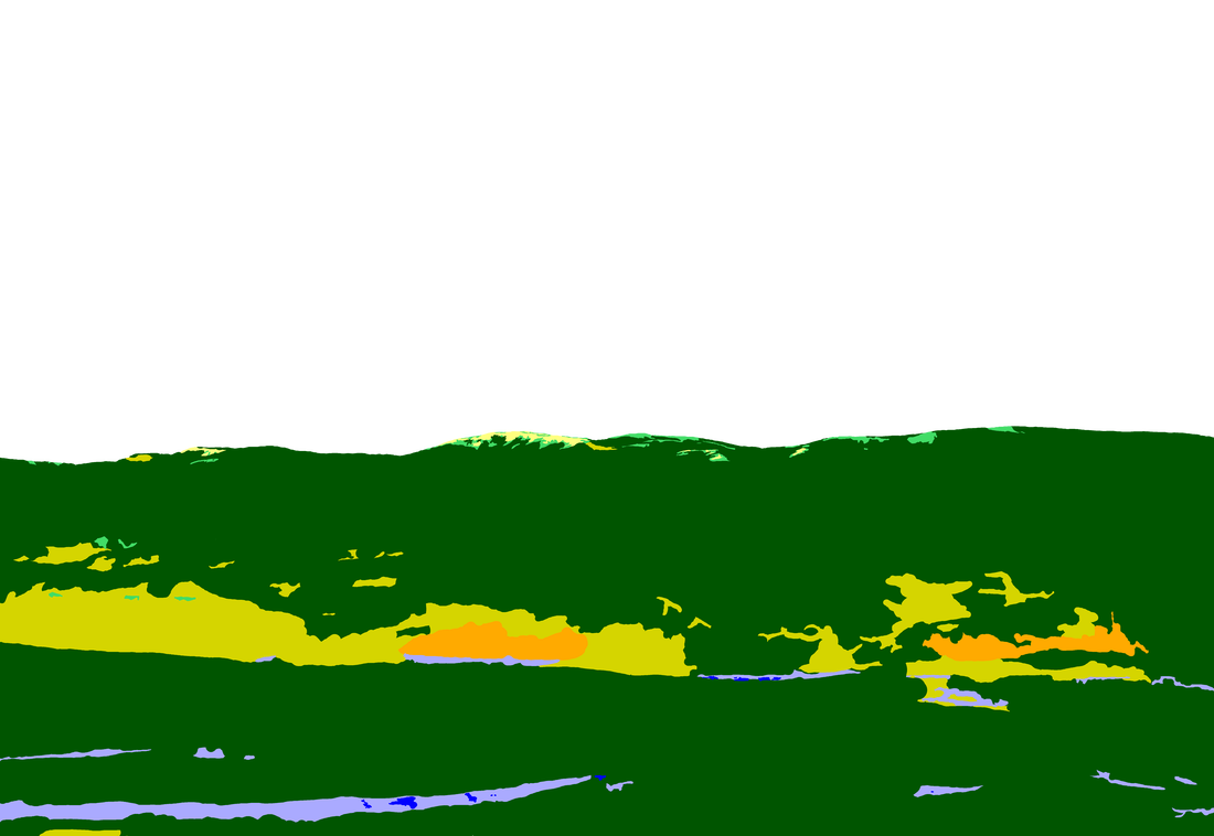
Analysis of Percentage per Category in 1946 Image 82 and 2016 Image 689
|
Discussion
|
Looking at the images we there has been an approximately 13% increase in the Coniferous Forest category between 1946 and 2016. However, the historic and modern images had a sizable portion of this category to begin with (73.2% and 86% respectively). Perhaps the more interesting change to note is the upward creep of the forest cover. Along the ridge line in the image pair Mixedwood Forest and Upland Shrub in the '46 image have become Coniferous Forest in the 2016 picture. Figure 1 gives a quick visual comparison.
|
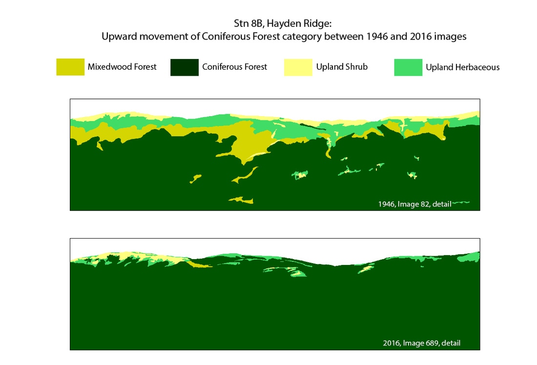
Figure 1: Ridge top detail from Classification images 82 and 689.
Stn 8B, Hayden Ridge.
|
